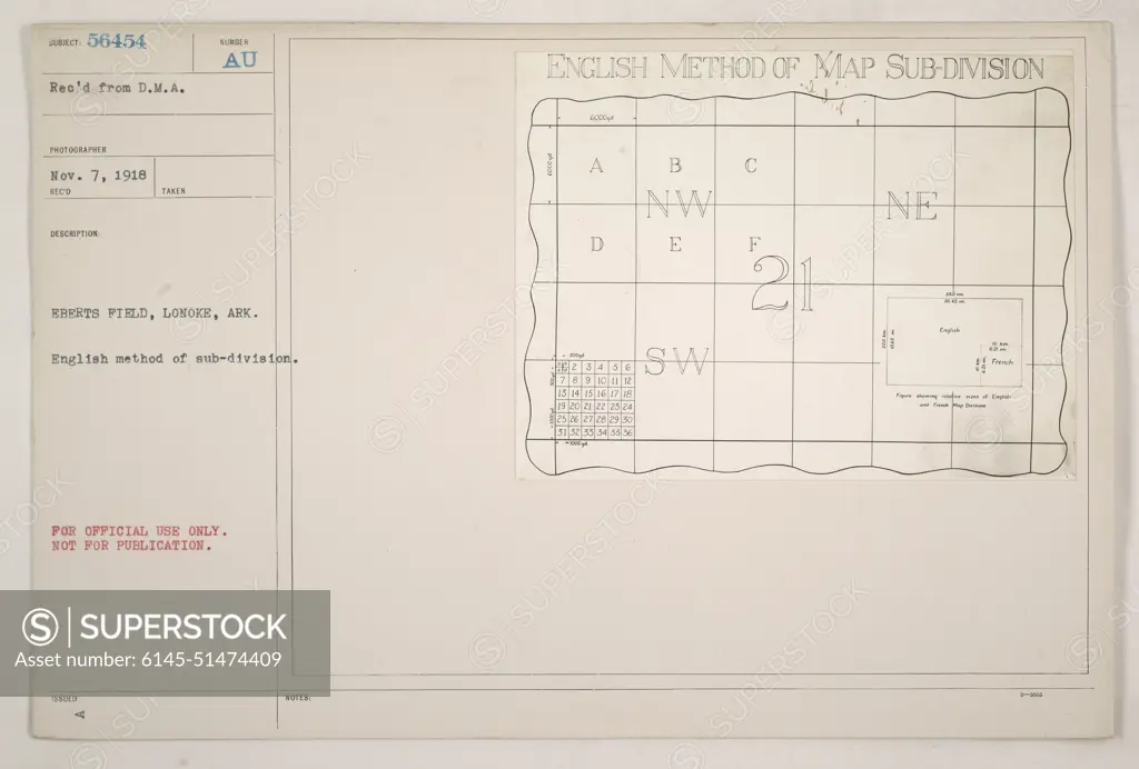
Aerial view of Eberts Field in Lonoke, Arkansas. The photograph shows the English method of map subdivision using the SURECT system. This image was received from the D.M.A. photographer on November 7, 1918 and was taken at Eberts Field. The map subdivision numbers and letters are clearly visible. Please note that this image was classified for official use only and not for publication.
SuperStock offers millions of photos, videos, and stock assets to creatives around the world. This image of Aerial view of Eberts Field in Lonoke, Arkansas. The photograph shows the English method of map subdivision using the SURECT system. This image was received from the D.M.A. photographer on November 7, 1918 and was taken at Eberts Field. The map subdivision numbers and letters are clearly visible. Please note that this image was classified for official use only and not for publication. by PL Photography Limited is available for licensing today.
Looking for a license?
Click here, and we'll help you find it! Questions? Just ask!
Click here, and we'll help you find it! Questions? Just ask!
DETAILS
Image Number: 6145-51474409Royalty FreeCredit Line:PL Photography Limited/SuperStockCollection:PL Photography Limited Model Release:NoProperty Release:NoResolution:8529×5771