An Accurate map of the present seat of war between Great-Britain and her colonies in North America, 1776. Created by John Hinton, this map, published in London by J. Hinton, features hand coloring and measures 26 x 34 cm. It illustrates the geographical context of the conflict occurring in North America during this period
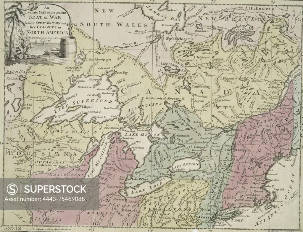
SuperStock offers millions of photos, videos, and stock assets to creatives around the world. This image of An Accurate map of the present seat of war between Great-Britain and her colonies in North America, 1776. Created by John Hinton, this map, published in London by J. Hinton, features hand coloring and measures 26 x 34 cm. It illustrates the geographical context of the conflict occurring in North America during this period by Artokoloro is available for licensing today.
Looking for a license?
Click here, and we'll help you find it! Questions? Just ask!
Click here, and we'll help you find it! Questions? Just ask!
DETAILS
Image Number: 4443-75469088Rights ManagedCredit Line:Artokoloro/SuperStockCollection:Artokoloro Model Release:NoProperty Release:NoResolution:4165×3183