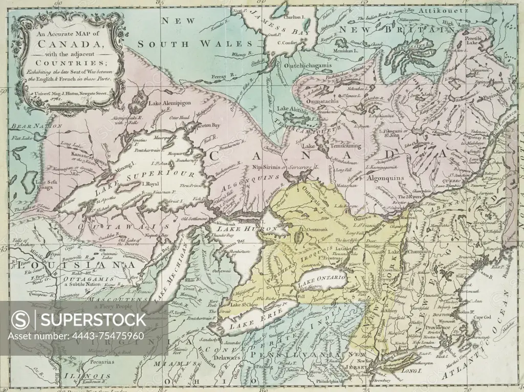
An accurate map of Canada with adjacent countries, illustrating the recent conflict between the English and French in the region, dated 1761. Created by John Hinton, the map is hand-colored and measures 25 x 33 cm. It was published in London by Univers. Mag., located on Newgate Street
SuperStock offers millions of photos, videos, and stock assets to creatives around the world. This image of An accurate map of Canada with adjacent countries, illustrating the recent conflict between the English and French in the region, dated 1761. Created by John Hinton, the map is hand-colored and measures 25 x 33 cm. It was published in London by Univers. Mag., located on Newgate Street by Artokoloro is available for licensing today.
Looking for a license?
Click here, and we'll help you find it! Questions? Just ask!
Click here, and we'll help you find it! Questions? Just ask!
DETAILS
Image Number: 4443-75475960Rights ManagedCredit Line:Artokoloro/SuperStockCollection:Artokoloro Model Release:NoProperty Release:NoResolution:4447×3328