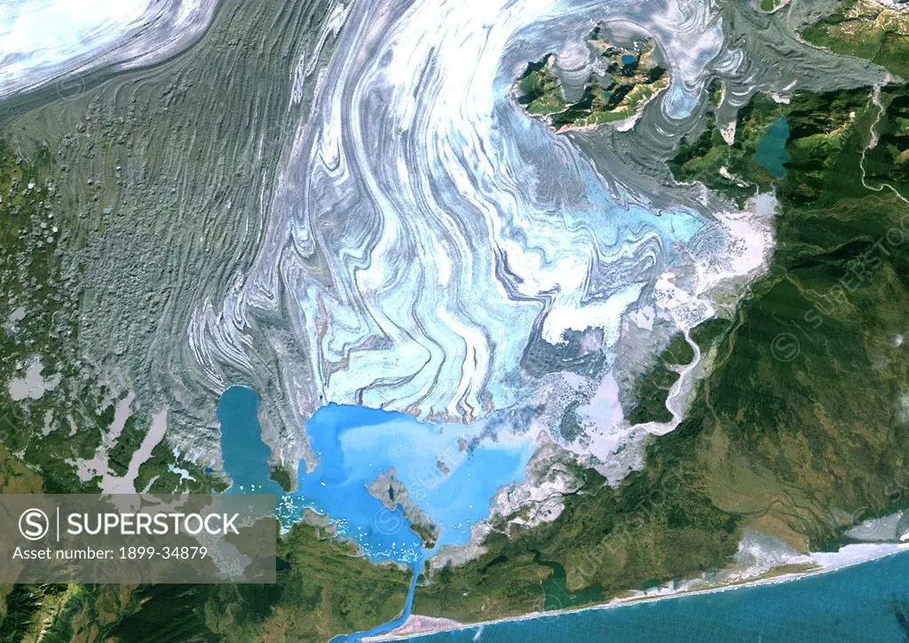
Bering Glacier, Alaska, Usa, True Colour Satellite Image. Satellite image of the Bering Glacier, the largest glacier in North America. It currently terminates in Vitus Lake (South East on the picture), about 10km from the Gulf of Alaska, and flows into the sea through a small outlet. The glacier is bordered by gray moraines. Image taken on 25 September 1986 using LANDSAT data.
SuperStock offers millions of photos, videos, and stock assets to creatives around the world. This image of Bering Glacier, Alaska, Usa, True Colour Satellite Image. Satellite image of the Bering Glacier, the largest glacier in North America. It currently terminates in Vitus Lake (South East on the picture), about 10km from the Gulf of Alaska, and flows into the sea through a small outlet. The glacier is bordered by gray moraines. Image taken on 25 September 1986 using LANDSAT data. by Universal Images is available for licensing today.
DETAILS
Image Number: 1899-34879Rights ManagedCredit Line:SuperStock / Universal ImagesCollection: Universal Images Model Release:NoProperty Release:NoResolution:4961×3508
Free Research
Can't find the usage you need?
We're here to help!
Phone: +1 866 236 0087
Email: help@superstock.com
Research / License Request Form
Can't find the usage you need?
We're here to help!
Phone: +1 866 236 0087
Email: help@superstock.com
Research / License Request Form
Retouching Services
Our MediaMagnet division offers comprehensive retouching services at great rates. For a free quote, please send us an e-mail and we'll get back to you promptly.
Email: Retouching Service
Our MediaMagnet division offers comprehensive retouching services at great rates. For a free quote, please send us an e-mail and we'll get back to you promptly.
Email: Retouching Service