This map, which shows the main ocean trenches, was prepared using altimeter data from the Seasat oceanographic satellite. Seasat was launched on 27th ...
This image has restrictions and cannot be purchased online. Get in touch for more details.
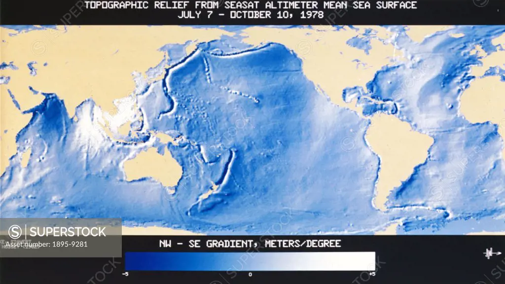
SuperStock offers millions of photos, videos, and stock assets to creatives around the world. This image of This map, which shows the main ocean trenches, was prepared using altimeter data from the Seasat oceanographic satellite. Seasat was launched on 27th ... by NASA/SSPL/Science and Society is available for licensing today.
DETAILS
Image Number: 1895-9281Rights ManagedCredit Line:SuperStock / NASA/SSPL/Science and SocietyCollection: Science and Society Contributor: NASA/SSPL Model Release:NoProperty Release:NoResolution:2490×1403
Free Research
Can't find the usage you need?
We're here to help!
Phone: +1 866 236 0087
Email: help@superstock.com
Research / License Request Form
Can't find the usage you need?
We're here to help!
Phone: +1 866 236 0087
Email: help@superstock.com
Research / License Request Form
Retouching Services
Our MediaMagnet division offers comprehensive retouching services at great rates. For a free quote, please send us an e-mail and we'll get back to you promptly.
Email: Retouching Service
Our MediaMagnet division offers comprehensive retouching services at great rates. For a free quote, please send us an e-mail and we'll get back to you promptly.
Email: Retouching Service